
When the Earth Trembles: A Close Call for Istanbul
On 23 April 2025, at precisely 12:49 local time, a magnitude 6.2 earthquake struck beneath the Sea of Marmara in northwestern Türkiye. While it thankfully did not turn into a major disaster, the tremor served as a stark reminder of the region’s tectonic volatility and the looming threat that continues to hover over the densely populated city of Istanbul.

Shaking the Region
The earthquake, although offshore, sent tremors rippling across the northwestern part of the country. More than 3,000 reports were submitted to the European-Mediterranean Seismological Centre (EMSC), detailing the quake’s impacts. While no deaths were reported, over 150 people sustained injuries, primarily from jumping out of buildings in panic. Citizens described partial structural damage, falling objects, and pool water sloshing out violently. The most intense shaking was felt in Çorlu, northwest of the epicentre, where ground motion reached levels VI to VII on the intensity scale.
A Warning Shot?
Remarkably, this quake was preceded by a magnitude 3.9 foreshock just 33 minutes earlier, also widely felt. Although foreshocks can be early signs of something bigger, they are notoriously unreliable for predictions. Retrospectively, scientists can identify them, but predicting which small tremor will precede a larger quake remains guesswork. Likewise, while there is a slim chance (about 5%) that this M6.2 could itself be a foreshock for a larger event, the odds offer little certainty.
Aftershocks and Fault Behaviour
Following the mainshock, more than 100 aftershocks were recorded, with three reaching magnitude 5. These aftershocks outlined an eastward rupture zone about 20-25 km in length, consistent with the expected rupture area for a quake of this magnitude. Interestingly, the shaking wasn’t strongest near the epicentre—a phenomenon likely caused by local ground conditions. Soft sediments can amplify seismic waves, creating irregular patterns of felt intensity.
The Fault Beneath the Sea
The Sea of Marmara lies atop the western end of the North Anatolian Fault (NAF), a colossal 1,000-kilometre-long strike-slip fault dividing the Eurasian and Anatolian tectonic plates. The Anatolian Plate creeps westward at about 2 cm per year, mostly accommodated by the NAF. Historically, the fault has ruptured progressively westward, beginning in the east in 1939 and culminating in the devastating M7.6 Izmit earthquake of 1999.
The section beneath the Sea of Marmara is of particular concern. Some segments of the fault here are creeping—moving slowly and continuously—while others are locked and building stress. It was at the transition between these two behaviours that the recent M6.2 occurred. Scientists have long warned that this transition zone near the Kumburgaz Basin could be the starting point for a much larger rupture toward Istanbul.
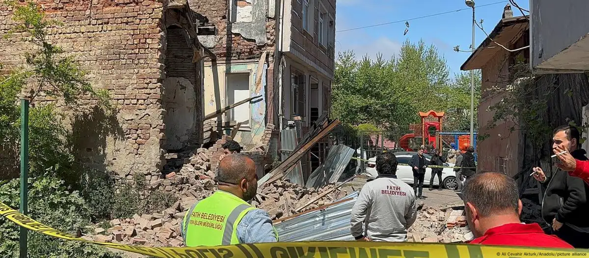 Photo: Ali Cevahir Akturk/Anadolu/picture alliance
The Next Big One?
Earthquake researchers estimate a 47% probability of a magnitude 7.3 or greater earthquake near Istanbul within the next 30 years—a forecast made almost a decade ago. The city, home to over 16 million people, is built on sediments that exacerbate shaking and includes many vulnerable, older buildings. The stakes couldn’t be higher.
Looking at history, the 1509 and 1766 earthquakes, both above magnitude 7, caused massive destruction in what is now Istanbul. Since 1766, over 4.5 metres of tectonic slip has likely built up beneath the Sea of Marmara. This unrelieved strain is like a loaded spring.
Final Thoughts
The recent earthquake, while not catastrophic, was nature’s reminder that the North Anatolian Fault remains active and dangerous. It wasn’t "the big one" Istanbul dreads—but it was a wake-up call. Scientists continue to monitor the region with increasing urgency, knowing that preparedness today could mean survival tomorrow.
Stay informed, stay aware, and as always, science will continue watching the fault lines.